

Exploring the Snohomish River Ecosystem
Exploring the Snohomish River Ecosystem
Warning: exploring these spots may make you an estuary nerd too.

One of my missions in this newsletter is to encourage readers to explore their local environment. In this post I’m going to share a bunch of my favorite spots in the Snohomish River Ecosystem, and links to other things I’ve written about this area:
For two years, I’ve been exploring this area intently. The pandemic “helped,” anchoring me at home. With no need to get ready for work, commute, travel for work, etc., I’ve had way more time on my hands. So I started to explore close at hand.
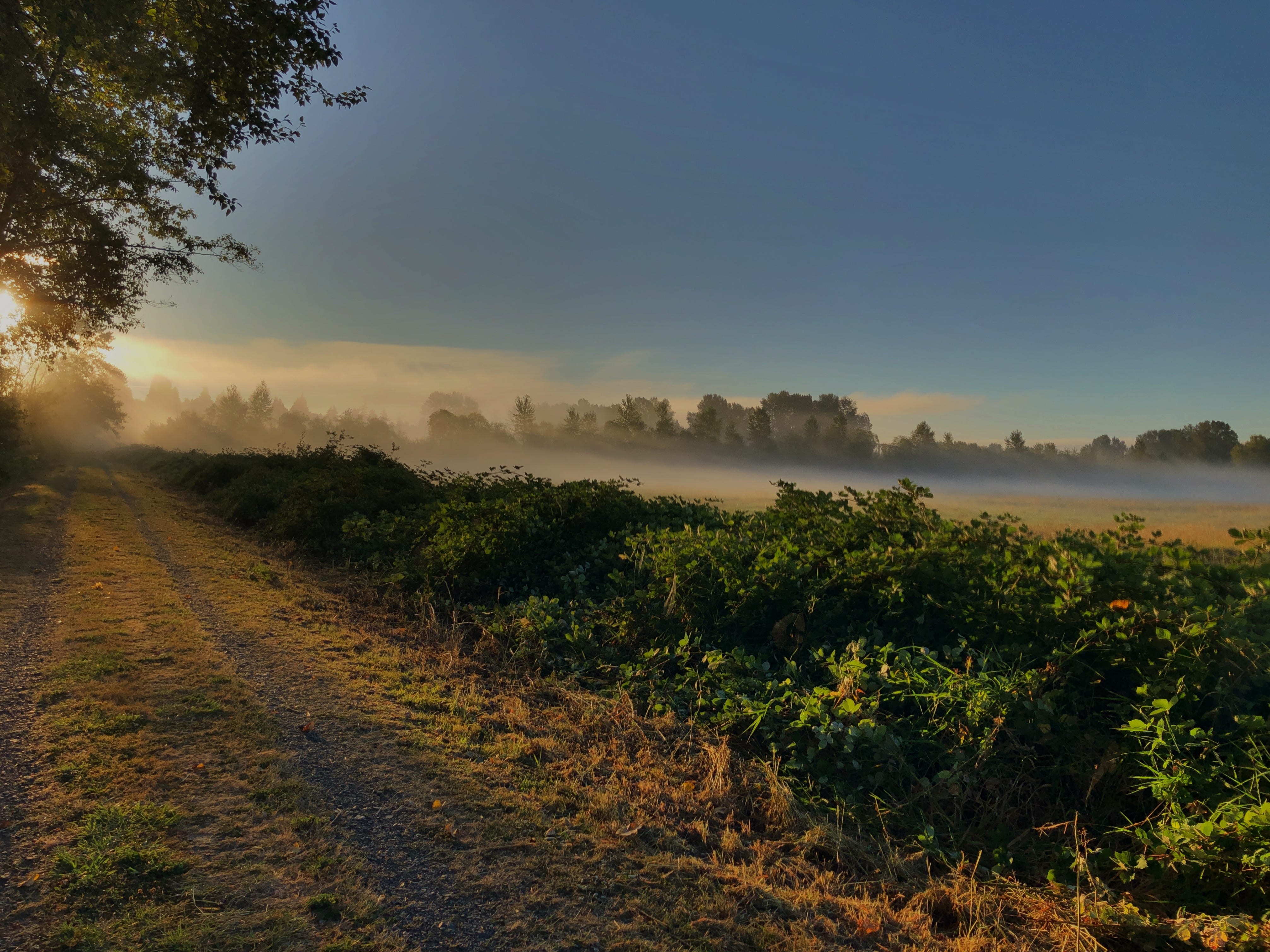
Sara and I began to seek out every little county park and city trail we could find within 50 miles. (I joked to someone yesterday that if it didn’t have a “No Trespassing” sign, it seemed like fair game.) Pretty quickly we zeroed in on what lay closest at hand: the incredibly rich terrain of the Snohomish River estuarine environment (just for fun, try pronouncing “estuarine.” If it rolls off your tongue, I’m impressed!)
I started by walking out my front door and down the street to the Riverview Wildlife Refuge. So entranced was I by this place that I renamed it Vetucchio.
Going down there day after day piqued my curiosity:
What was right across the river from Vetucchio? Field’s Riffle, it turns out. (A “riffle,” by the way, is “a rocky or shallow part of a stream or river with rough water,” and the term is only used in North America.)
What was it like upstream? There lies Lord Hill Regional Park, Thomas’s Eddy, and other less-developed access points.
What happened downstream? Here, options abound, though my favorites are the Fobes-Ebey Slough Dike Road Trail and Spencer Island.
This quickly became a quest to find every publicly accessible walking trail in this area, and I’ve made a Google map that includes the spots I’ve found (so far). This is a “living map,” meaning I’m adding to it over time and I will refer back to it. In fact, I’ve already added a map layer for places to grab a beer that you can use if you go to the map and turn on that layer. Next layer: fried chicken. (And the map is also on my website, at Exploring the Snohomish River Ecosystem, where I’ll keep an updated list of articles and other resources on the subject.)

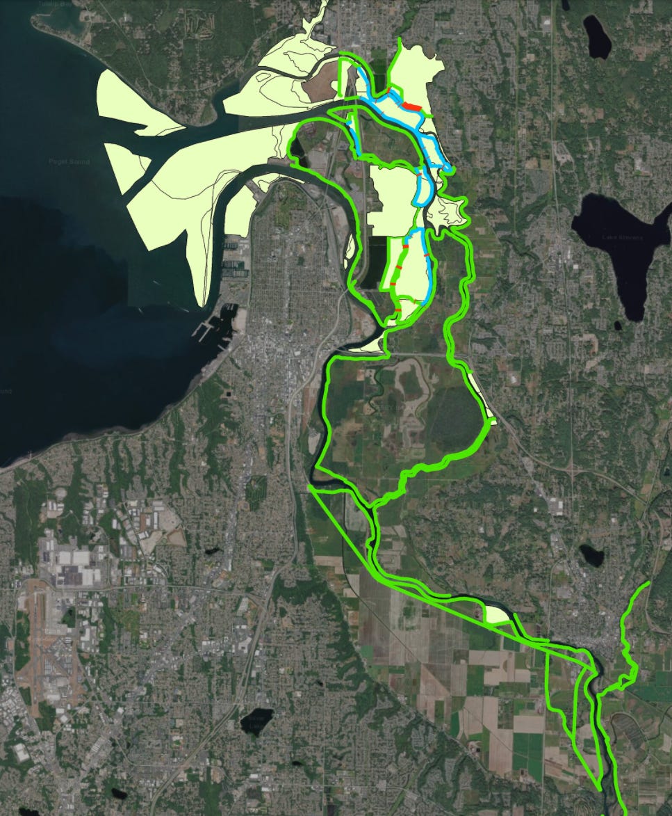
There’s rarely a trip into this environment that doesn’t prompt another question: Who built these dikes I’m walking on? What purpose do they serve—and what do they thwart? Questions like this take me deeper into understanding this ecosystem. I’ve barely gotten started, but have discovered one online resource that is worth a little time for anyone living here. It’s about salmon habitat—but it goes deep into the recent history of our estuary. This online story called Snohomish Salmon was created by the Washington Department of Fish and Wildlife. If you thought government agencies couldn’t produce great content, especially great digital content, you’ll be very pleasantly surprised. The map below shows the man-made dikes in the estuary, with blue showing abandoned dikes and red showing major breaches. I wish I could walk along every inch of these dikes, but many are on private property and you know how I feel about “No Trespassing” signs.
If you’re in the area, I urge you to try one of the walks from my map. Please let me know what you discover, either in comments or in an email. And if you want company, you know how to reach me!
news I can use, thanks ~w.
Love the post Tom and all the effort that went into it - great work. When's the vegan restaurant map layer going to be available?